GEOPHYSICS METHODS AND APPLICATIONS
EPI Geophysics provides geophysical survey services that benefit environmental engineering, civil engineering and construction projects. We utilize our experience to design geophysical surveys that are likely to achieve the client's exploration objectives.
Our land survey services include: seismic, ground penetrating radar, (GPR), electromagnetic , magnetic, resistivity, and pipe locating.
Our project geophysicists have up to 20 years of experience each performing applied geophysics. All of our field personnel are OSHA certified with annual medical monitoring and refresher training.
APPLICATIONS
ATTENTION TO DETAIL
QUICK PROPOSAL
TURNAROUND
We use PandaDoc for our proposal writing system. All parties are able to collaborate, electronically sign and communicate on the platform.
COLLABORATIVE
PROJECT SUPPORT
We pride ourselves on the word "team". Our project managers and support ensure your project will go smoothly from inception to the end of the project.

GEOPHYSICAL
ADVANTAGES
Geophysical services from EPI Geophysics enhance a wide variety of projects, including:
Environmental Site Assessments:
-
Detecting underground tanks, drums, and unexploded ordnance (UXO)
-
Delineating lagoons, trenches, and excavations
-
Mapping landfill boundaries and thickness
-
Characterizing landfill materials and disposal extent
-
Detecting contaminant plumes and estimating migration directions
-
Locating septic systems, drain pipes, and other conduits
-
Detecting clay-liner leaks
Hydrogeologic Investigations:
-
Profiling depths to bedrock, groundwater, and overburden strata
-
Locating transmissive bedrock fractures, and measuring fracture dip angles and down-dip compass azimuths
-
Measuring saturated overburden thickness
-
Detecting weathered and fractured bedrock
-
Evaluating continuity and depth of clay strata
-
Sinkhole detection and delineation
Geotechnical and NDT Studies:
-
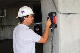
Detecting rebar, pipes, and conduits within concrete
-
Dynamic elastic moduli measurements in soil, bedrock, and concrete
-
Verifying pavement and subbase thicknesses along highways and railroads
-
Identifying void locations and depths beneath asphalt and concrete
-
Profiling depths to bedrock, groundwater, and overburden strata
-
Estimating material rippability
-
Determining earth resistance for high-voltage grounding systems
-
Locating bedrock fractures and faults
-
Delineating geologic contacts and lithologic changes
-
Detecting buried utilities and storm drains
-
Locating voids created by pipe installation or leaks
-
Monitoring void development within dams and under pavement
-
Delineating sinkholes in karst terrain
SCHEDULE A GEOPHYSICS DEMO FOR YOUR COMPANY
We offer free GPR presentations. A member of our geophysics manager team will come to your office to explain the benefits of GPR and demonstrate how EPI can help you and property owners save money and avoid the awful experience of striking, and likely damaging, buried utilities that would've been unknown without using GPR.
Since beginning demos, we've visited 25+ different companies and educated 265 project managers about how they can reduce the risk with geophysics. We discussed how One Call doesn't mark privately owned utilities like USTs and associated piping, gas and electric lines on the private property, well or city water, sprinklers and septic systems. It was very interesting to hear how many people didn't know that.
.png)


